Maps related to the Maritime Forest Project are in .jpg format. Click on text link to see a larger image.
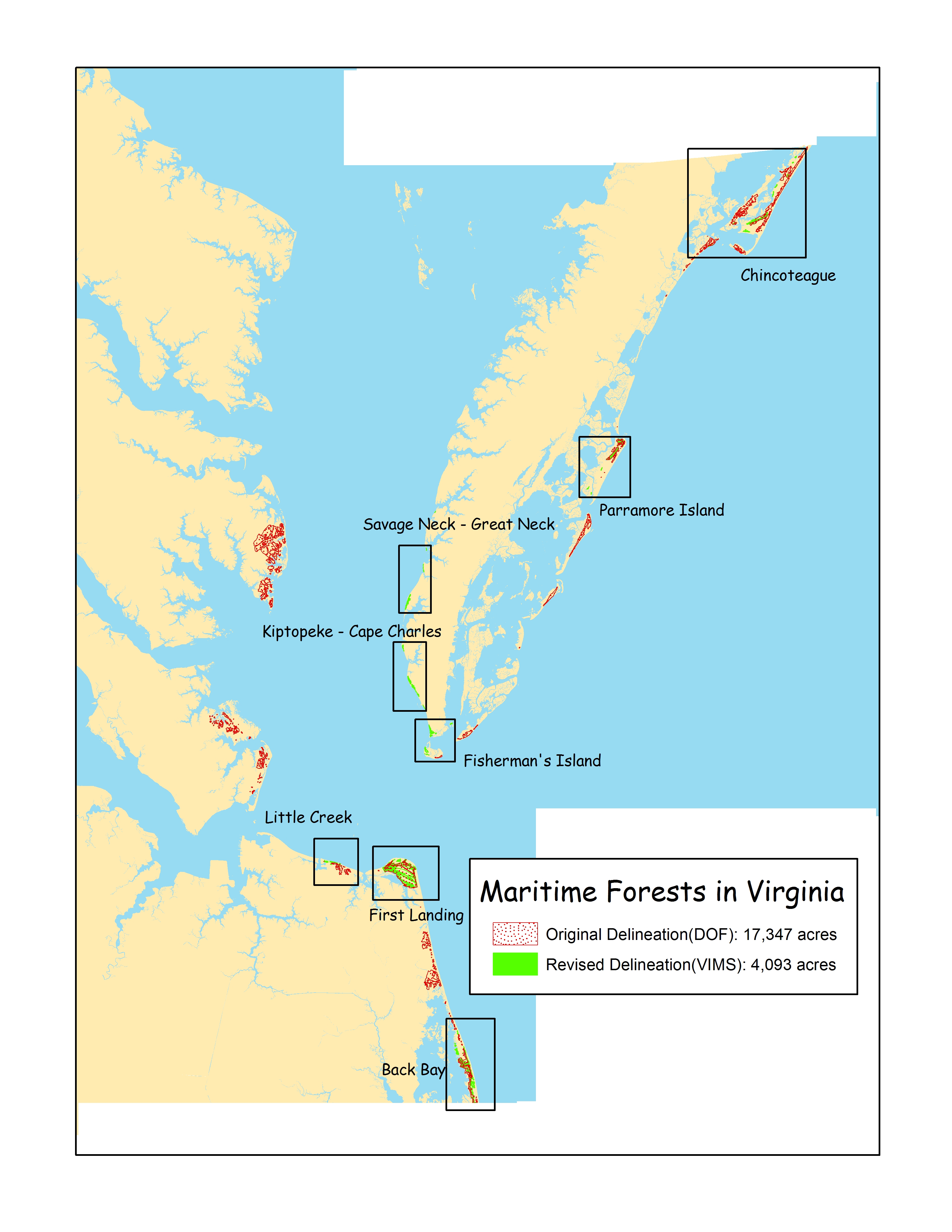
Maritime Forest Site Locations
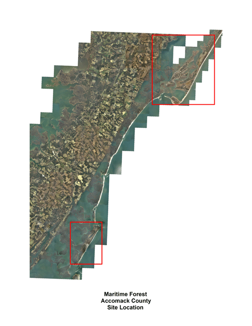
Accomack Site Locations
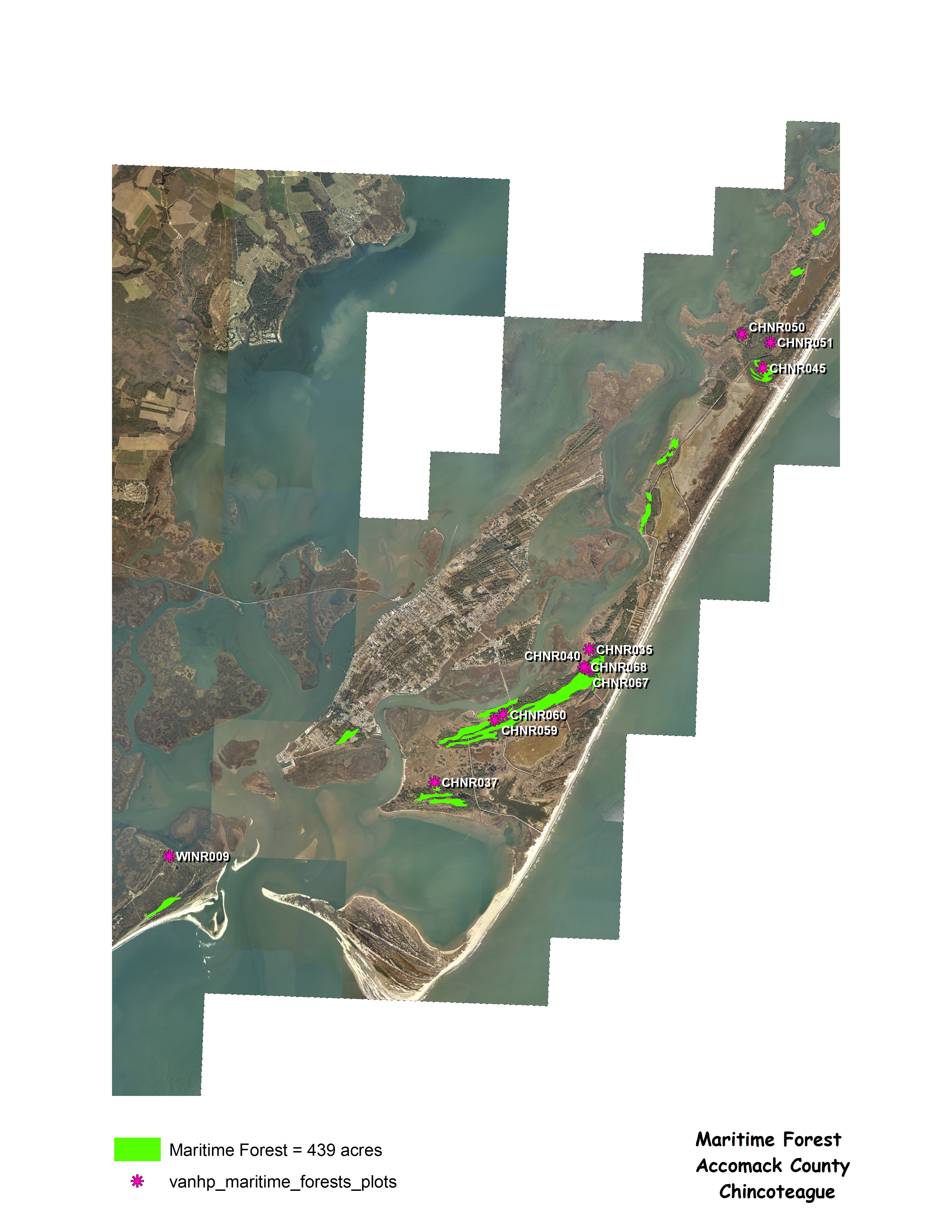
Chincoteague
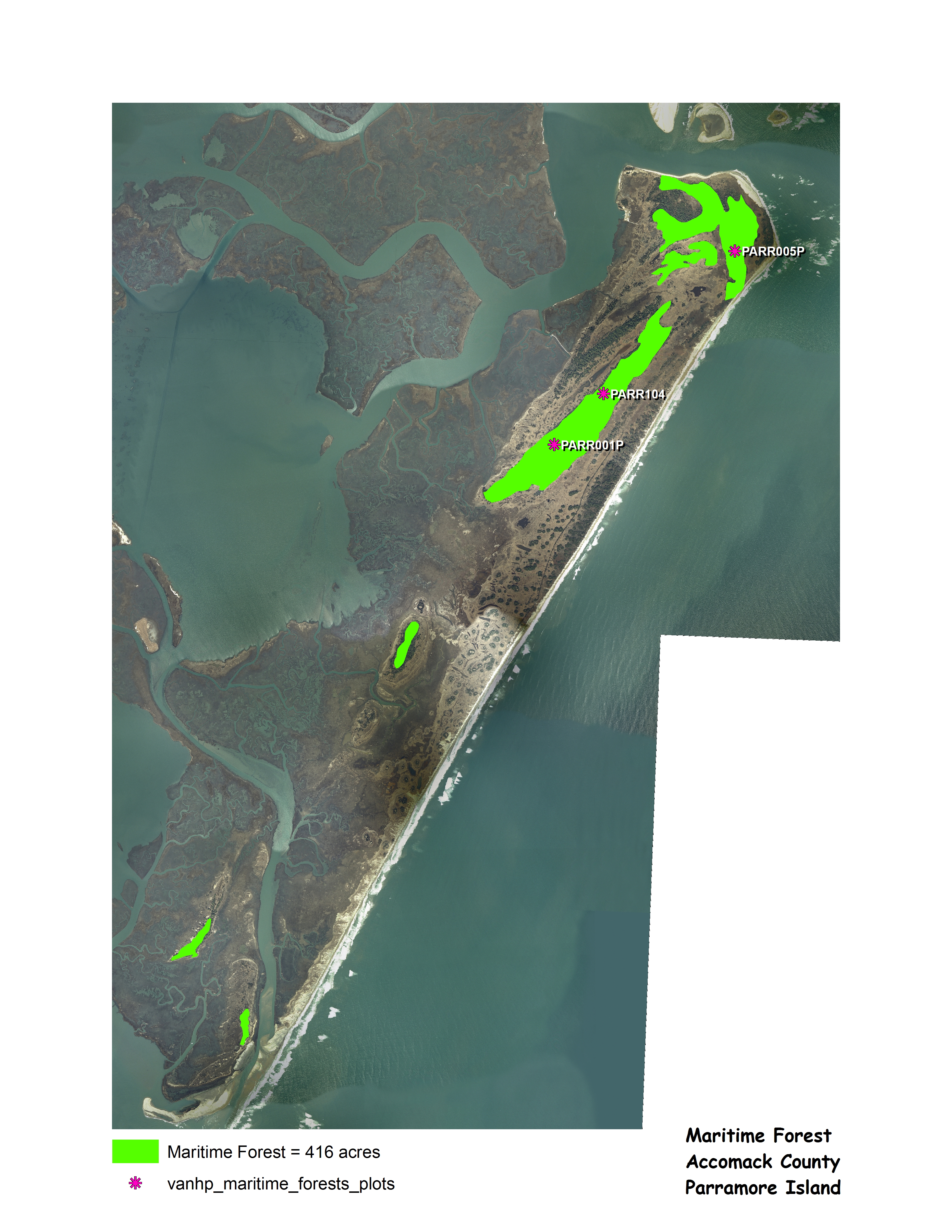
Parramore Island
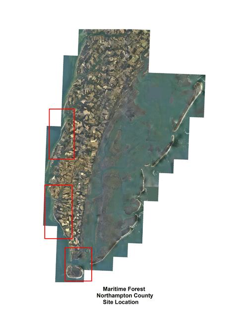
Northampton Site Location
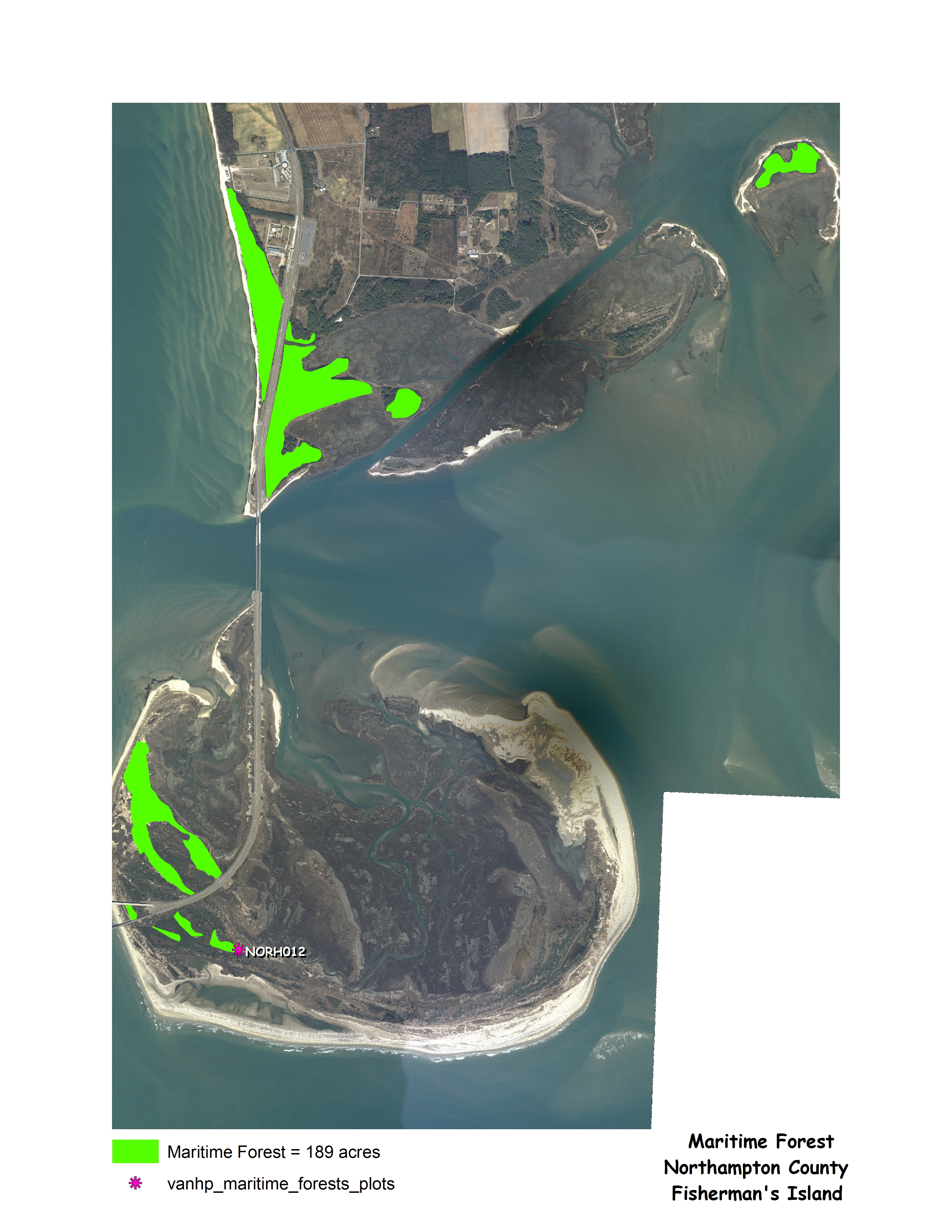
Fisherman's Island
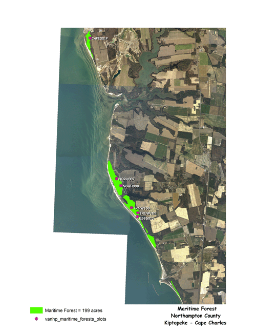
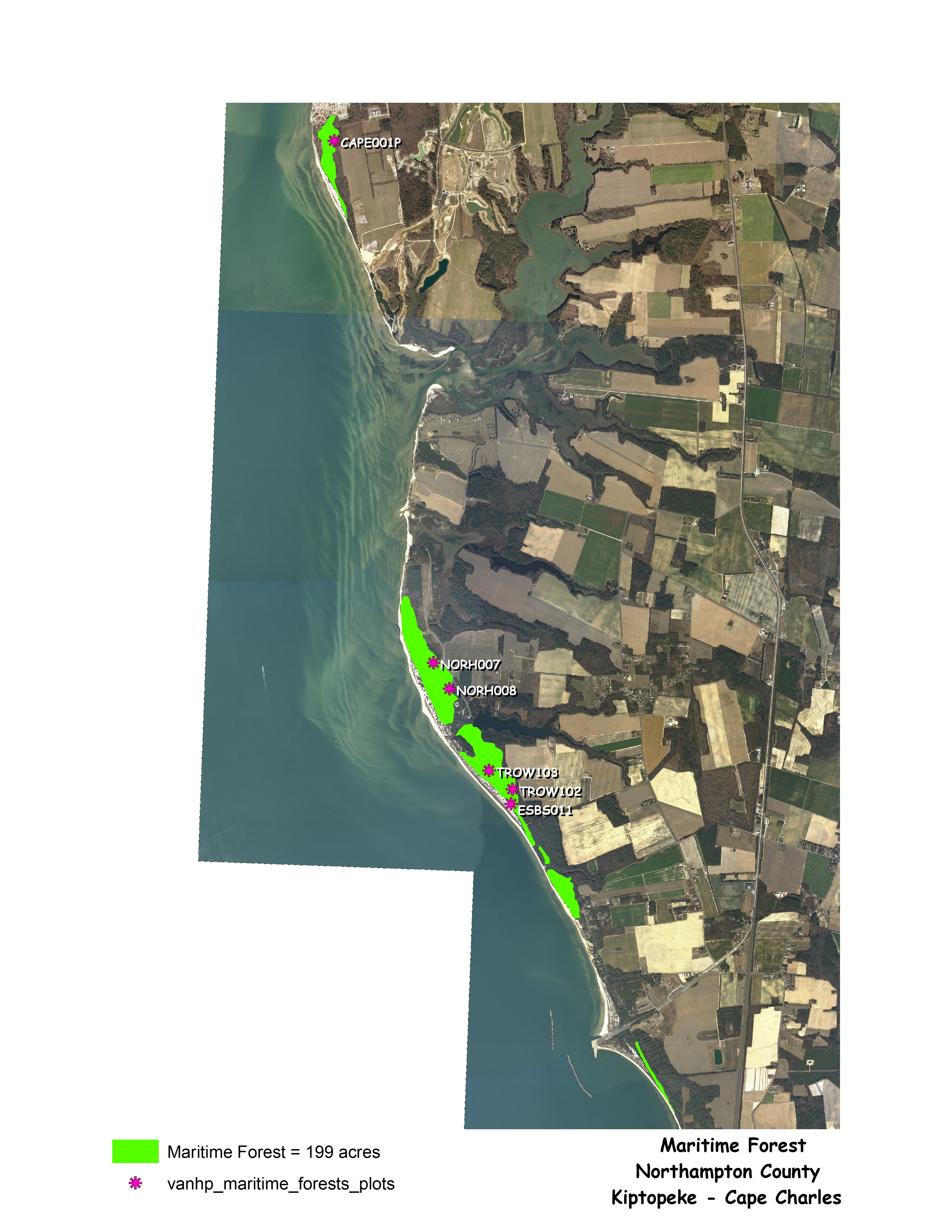
Kiptopeke State Park - Cape Charles
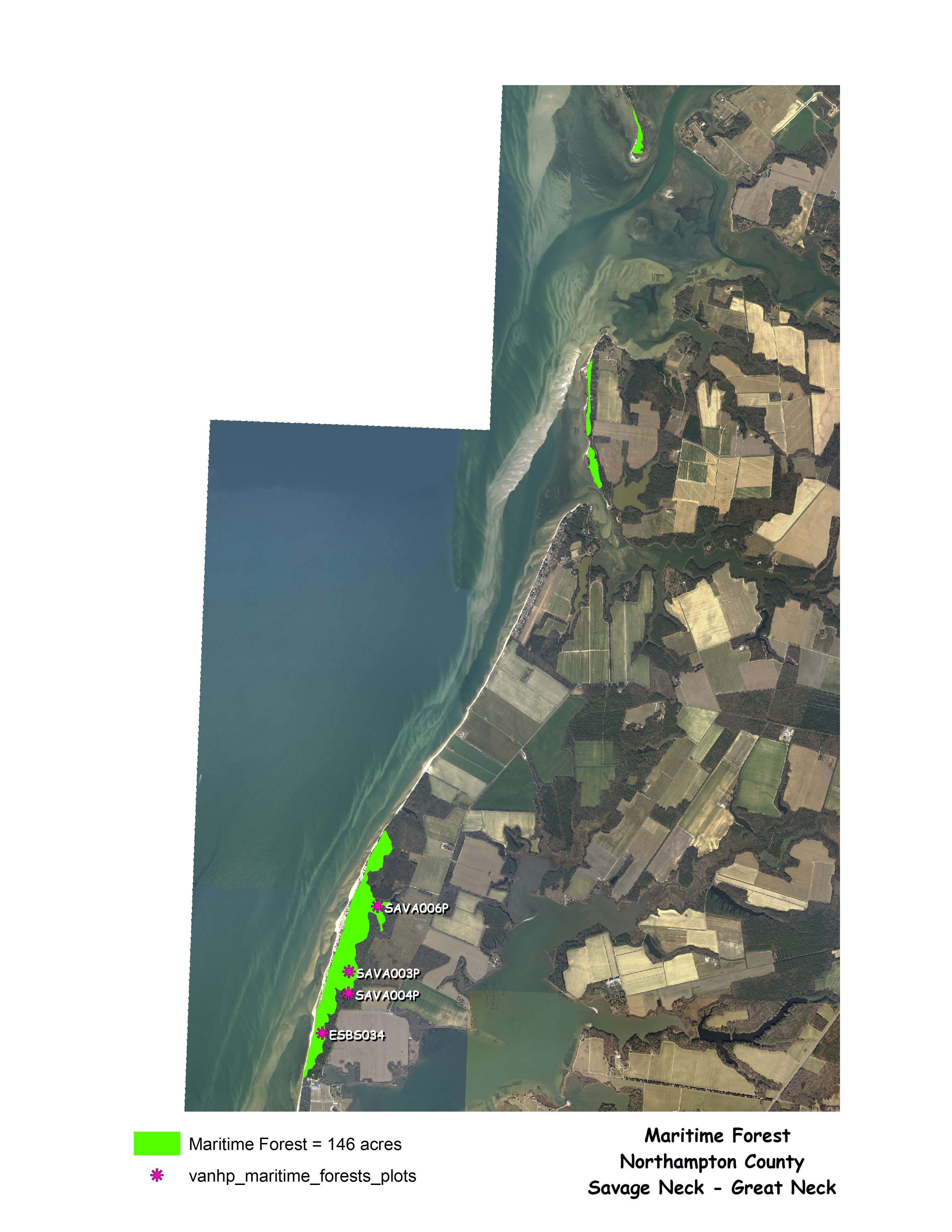
Savage Neck
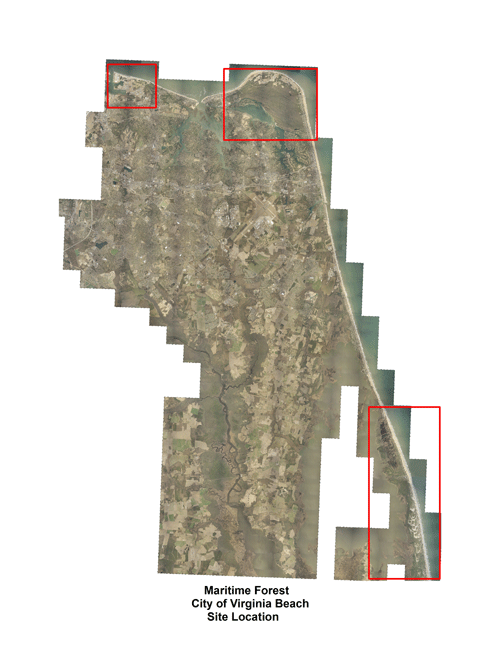
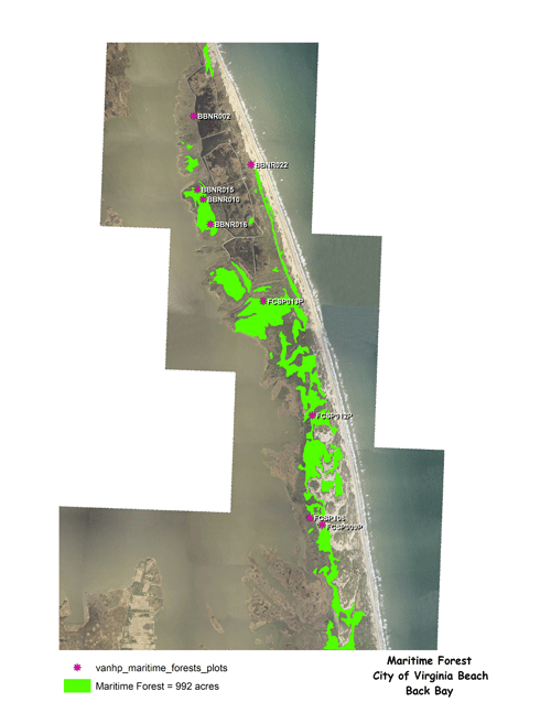
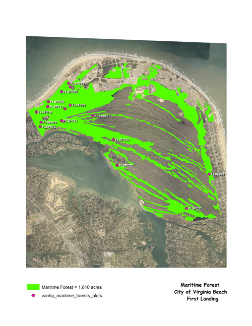
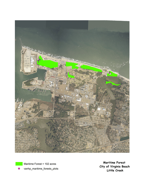
Virginia Beach Site Location
Back Bay Wildlife Refuge
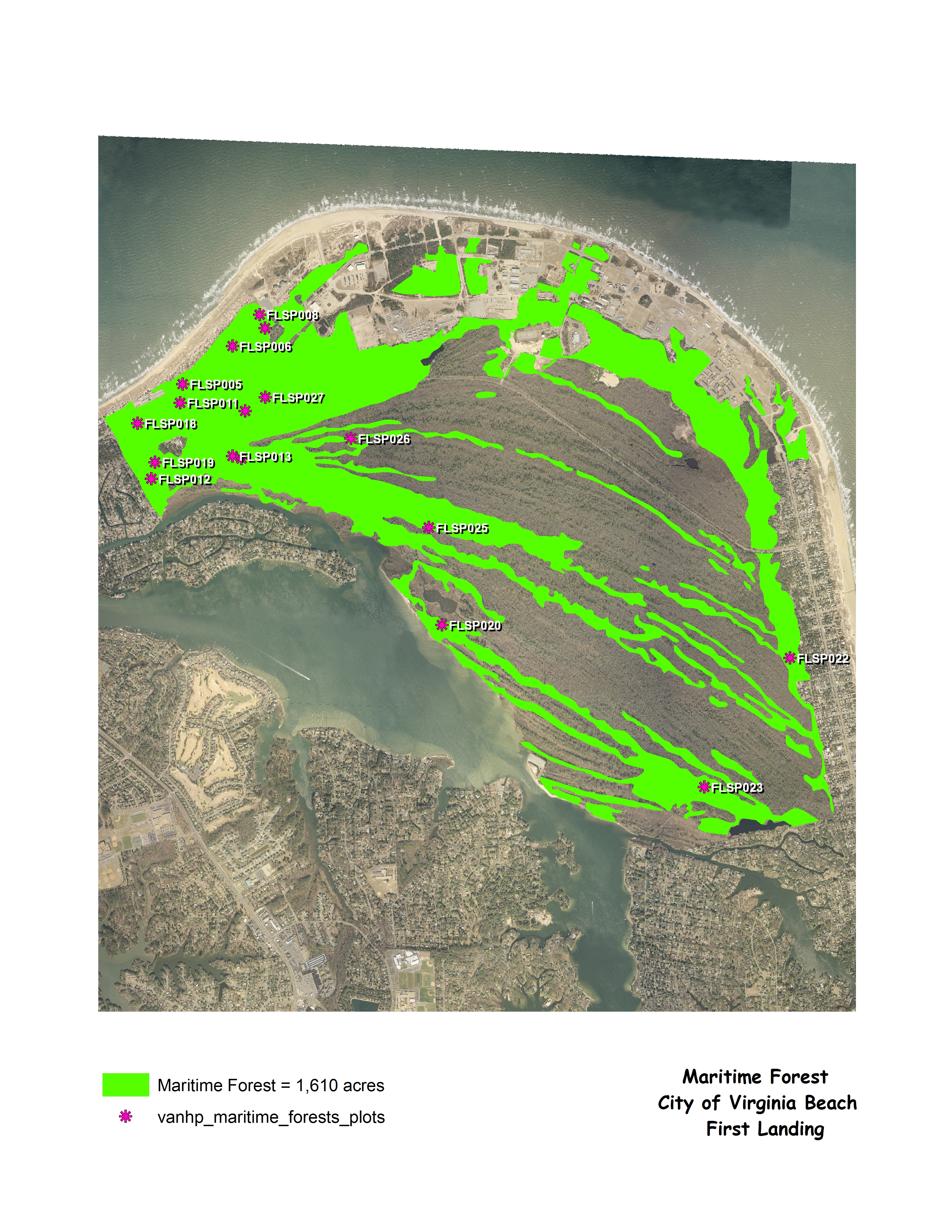
First Landing State Park
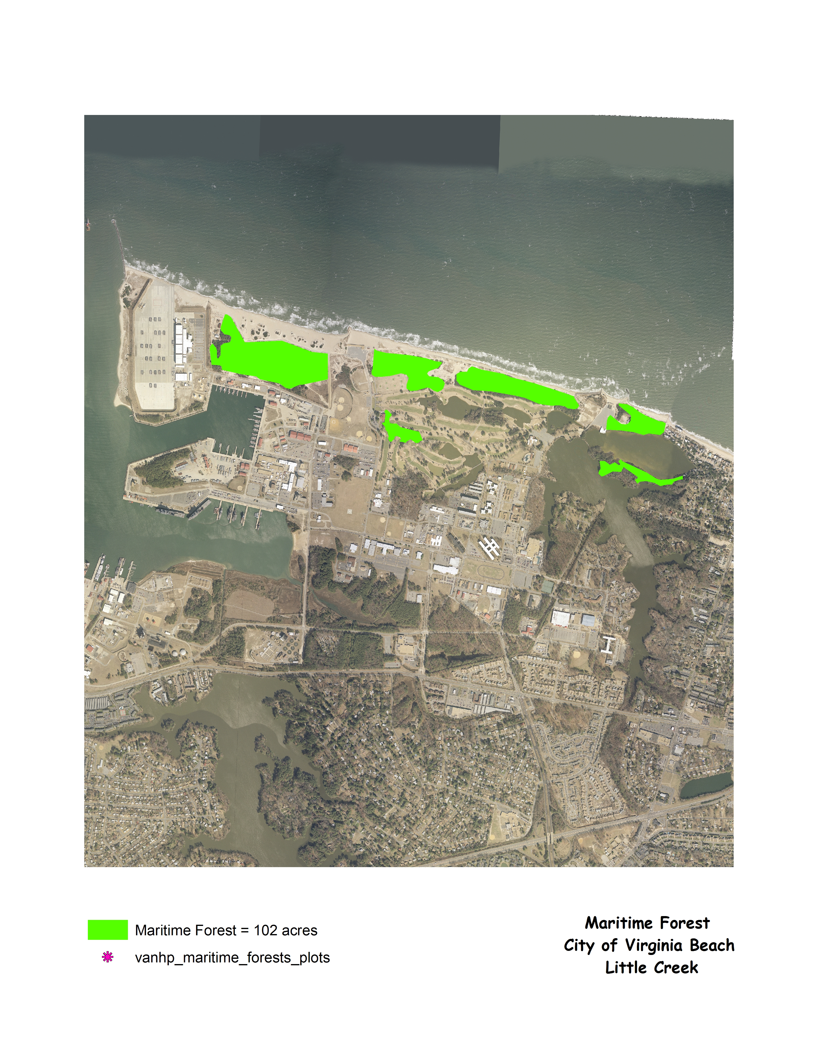
Little Creek Site Location


