VaBay Maps
The VaBay Project is an interactive report of environmental conditions and management plus restoration efforts in Virginia waters by Commonwealth environmental agencies. VaBay provides links to background information and related materials through a "dashboard" consisting of the following elements: Living Resources, Maps, Land Use & Population Trends, Restoration, TMDL, and Current Conditions. The goal of the project is to enhance understanding of Bay and watershed water quality conditions, as well as necessary improvement actions.

|
Select by TMDL Segment Shed - Users may view environmental conditions which are specific for a selected segment shed. |
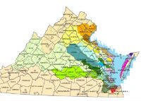 |
Select by County - Users may view environmental conditions which are specific for a selected county. |
|
|
