|
Climate Change - Piankatank River - Mesohaline (PIAMH)
CURRENT COASTAL HABITAT COMPOSITION
5.0km² - Tidal Marsh
3.8 km² - Submerged Aquatic Vegetation
26.7 km² - Shallow Water
41.5 km - Beaches
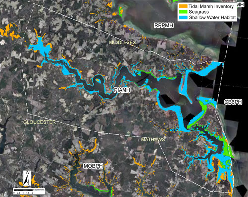
The Piankatank River is located in Mathews, Gloucester and Middlesex Counties and is predominantly residential in character. Much of the shoreline is developed (52% developed riparian lands and 20% hardened shoreline). All counties have moderate-high average annual rates of permitted shoreline hardening ranging from 1.3-1.7 km/yr (0.2-0.5% of the shoreline).
COASTAL HABITATS SHIFTS WITH CLIMATE CHANGE
-
Shallow-Water and Tidal Wetlands - depiction of existing tidal wetland (vegetated & non-vegetated) and shallow-water habitat, with projected shifts due to sea level rise
-
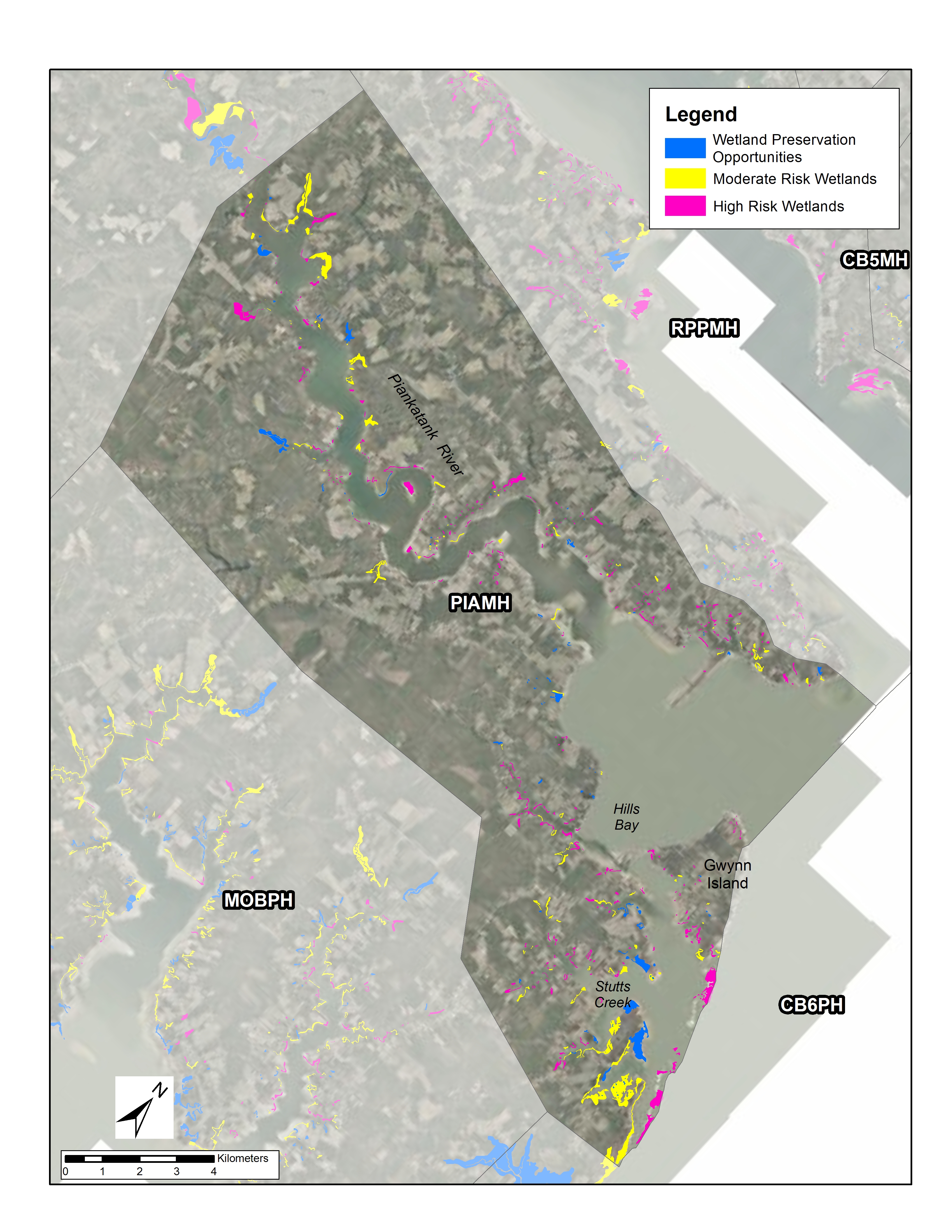
Tidal Marsh Vulnerability - depiction of existing tidal marsh and vulnerability to inundation from projected sea level rise within 50-100 years. Marshes classified at low risk represent potential wetland preservation opportunities
-
Submerged Aquatic Vegetation - depiction of existing submerged aquatic vegetation (SAV) and projected shifts due to sea level rise and elevated temperatures
Link to map information and data sources |
|