|
Research: Current Research Projects
Click on the box of interest for more information on current research projects.
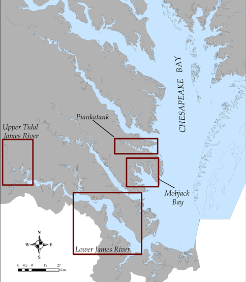
Piankatank River & Lower James River
The nearshore benthic habitat of the James and Piankatank rivers was surveyed with a bow-mounted Marine Sonics Sea Scan PC 600 kHz unit appropriate for shallow-water conditions (< 5m depth). Approximately 127 kilometers were surveyed on the North and South shores of the James River from the James River Bridge (Route 17) upriver to the Chickahominy River, and 47 km on the North and South shores of the Piankatank River from the mouth of the river at Fishing Bay upriver to Freeport.
Mobjack Bay
Data for the Mobjack Bay include submerged aquatic vegetation (SAV) distributions derived from aerial photography, benthic characterization (SAV, oyster reef and broad sediment class distributions) completed with side-scan sonar technology (Sea Scan Marine Sonics, 600 kHz) and an echo-sounder (Knudsen 320 BP; Kel 28/200 kHz dual-frequency transducer), and data derived from verification activities including sediment samples and video imagery.
Upper James River
Data for the Upper James River include benthic characterization (broad sediment class distributions, gravel beds) completed with side-scan sonar technology (Sea Scan Marine Sonics, 600 kHz) to assess the availability of Atlantic sturgeon spawning habitat. |
|